Creating a Chronotopic Ground for the Mapping of Literary Texts: Innovative Data Visualisation & Spatial Interpretation
Professor James Loxley (LLC) is contributing to this three-year collaborative project, which also involves researchers from Lancaster University, The Wordsworth Trust and The British Library. It explores the visualisation of literary place and space, using the digital medium in a way never before attempted to advance spatial understanding and interpretation of literary texts.
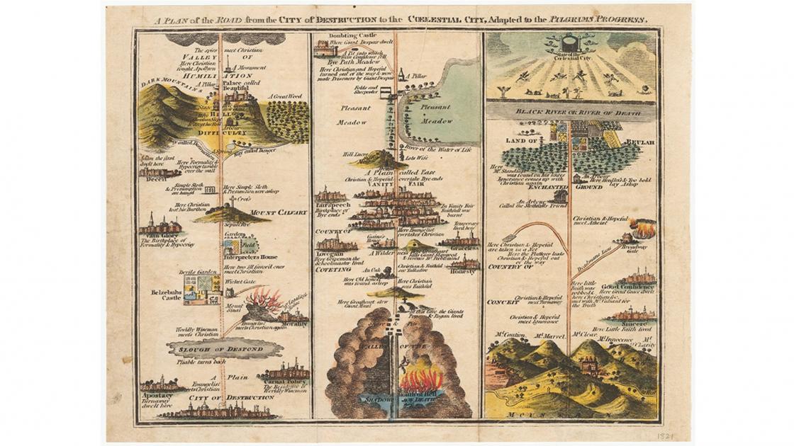
The space and time in literature are viewed as a central element of the understanding and interpretation of texts, but is often overlooked. Literary mapping has the potential to allow for this element to be understood and appreciated in new ways. If text is set in a space that corresponds to the real world, generating the "base map" is unproblematic. However, if a text creates a world with no direct correspondence, there is nothing on to which to map textual elements.
This ground-breaking project aims to solve this problem by creating the base map out of the text itself, using place-names and other toponymic elements to generate map representations. The project is funded by the Arts and Humanities Research Council (AHRC).